SATELLITE INFORMATION TO IMPROVE THE MANAGEMENT OF DAMS AND RESERVOIRS
Satellite information to improve the management of dams and reservoirs of the Canal de Isabel II
In February 2020, Land, Water, and Dams. S.L . was given the commission of the project “Satellite information service to optimize the management of the Isabell II Canal Dams and Reservoirs”. The contract began its execution on April 1st of the same year and was expected to be fully finalized on March 31, 2020.
The objective of the contract was focused on the attainment and processing of satellite data that would expand the existing knowledge of water quality in the reservoirs and improve the structural and hydrological safety of the dams. The project aimed to optimize the CYII’S planning of reservoirs exploitation system.
In this context, the provision of the service has reached the development of four objectives:
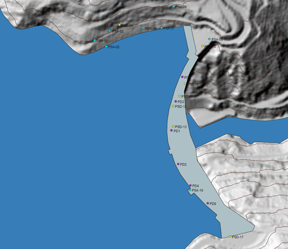
Publication of a quarterly bulletin of Din-SAR data based on the historical data of the last two years’ observations of the El Atazar dam (Community of Madrid) and the Guadiloba dam (Cáceres province).
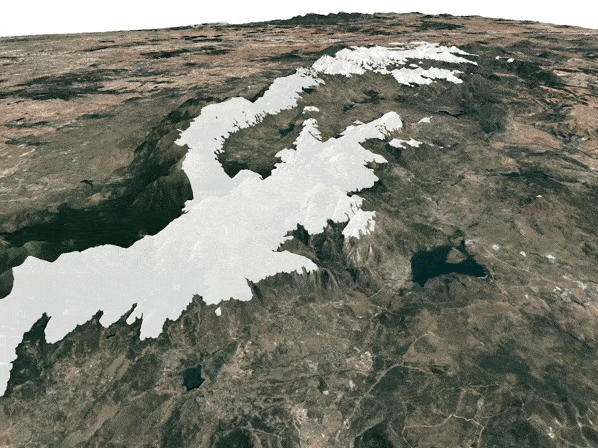
Generation of a weekly snow information bulletin for optical data, and fortnightly for radar data, during the snowy episodes of 2019/2020 and 2020/2021.
Provision of a weekly bulletin focused on water quality parameters: chlorophyll, turbidity and temperature; in the reservoirs of the CYII supply system to the Community of Madrid (Pinilla, Riosequillo, Puentes Viejas, El Villar, El Atazar, Pozo de los Ramos, El Vado, Navacerrada, Manzanares, Pedrezuela, Las Nieves, Valmayor, Navalmedio, La Jarosa, La Aceña), and the city of Cáceres (Guadiloba).
On April 26th 2021, after the conclusion of the contract, LWD delivered the final report compiling the results achieved during the provision of the service.